


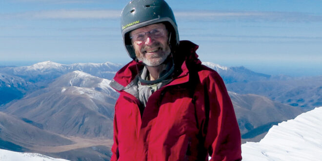
I grew up on the Cashmere Hills of Christchurch before moving on to explore the world and start a family. When I returned to live on these hills many years later, I was struck by my childhood memories of the awesome views across the Canterbury plains to the extensive ranges of the Southern Alps.
These memories were reinforced when I re-discovered a hand-drawn sketch of the panorama which had appeared in the Christchurch Press in 1967, drawn by Mr. I.D. Pugh. During my many years as a structural engineer in Christchurch, including some teaching at the University of Canterbury, I continued to go hiking and skiing in the hills. After re-discovering the panorama sketch, I found it immensely rewarding to come home from the mountains and look out my window to identify the peak I had been standing on a few hours previously.
As I approached retirement, I hatched a retirement plan to climb of all the 133 peaks named or numbered on Mr Pugh’s hand-drawn sketch. Now, ten years on, I have climbed them all and published an illustrated book about the views, the mountains, their history, and the climbs.
As well as modern paintings, the book includes sketches of the views seen by the first pakeha settlers who arrived in Lyttelton in the “first four ships” in 1850, after they struggled up the Bridle Path to see the uninhabited Canterbury Plains stretched out before them, with a backdrop of spectacular mountains.
The views from Christchurch of the peaks change every day, depending on the time of day, the season of the year and of course the weather, but they are always there.
The visible peaks extend 300 kilometres from Mt Peel in the south to the Kaikoura ranges in the north. They include peaks on the Two Thumb Range near Lake Tekapo, Mt Hutt, Fox Peak and other Canterbury skifields, and some on the Torlesse and Craigieburn ranges beyond Porters Pass. Looking further north, peaks near Hanmer and Molesworth are visible, and finally the spectacular Inland Kaikouras and the Seaward Kaikouras, can be seen across Pegasus Bay. Each range has become a separate chapter in the book.
Climbing the peaks required a great deal of planning. Among other things it was necessary to locate each peak on a map and determine the land ownership. Access across private land required permission, which as not always easy to get. It was then necessary to find climbing partners (many of them were retired university professors like myself) and a suitable weather forecast on a day when I was not busy doing my other retirement chores. All of my retired friends say there is not enough time to do everything on their bucket lists!
Some of the easier climbs were an afternoon stroll, but others required considerable mountaineering experience. Many peaks on the Canterbury Plains were simple day trips, but many of the remote climbs required overnight camping or nights in DoC huts.
The peak causing me the most concern was Aoraki / Mt Cook. Many Christchurch residents may not even realise it is visible from the Port Hills. I had always considered Aoraki / Mt Cook to be beyond my limited climbing ability, but I started to re-think it, as completion of the panorama challenge started to become a real possibility. In 2017 I approached Alpine Guides and asked if they would guide me to the summit on my 70th birthday, the following February. This was too late in the climbing season, so we agreed on a date later in the year, giving me some time for more intensive climbing practice. I was thrilled to reach the summit in December 2018, after a week’s wait in bad weather before a midnight start from Plateau Hut. It felt like being on top of the world.
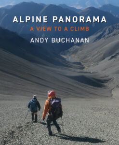
The book is Alpine Panorama – A View to a Climb published by Quentin Wilson Publishing, Christchurch. Available from bookstores or from the publisher at www.quentinwilsonpublishing.com. Recommended retail price $59.99.

Join the Discussion
Type out your comment here:
You must be logged in to post a comment.